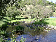
Fiddletown, California
Census designated place in California, United StatesFiddletown is a census-designated place in Amador County, California. It lies at an elevation of 1683 feet. It is located at 38°30′14″N 120°45′20″W. The town is registered as a California Historical Landmark and is listed in the National Register of Historic Places (NPS-78000655). The community is in ZIP code 95629 and area code 209. Fiddletown's population was 235 at the 2010 census.
Read article


Top Questions
AI generatedMore questions
Nearby Places

Plymouth, California
City in California, United States

D'Agostini Winery
Historic site in Plymouth, California

California Shenandoah Valley AVA
Viticultural area in California, US
Fiddletown AVA
Viticultural area in California, USA
River Pines, California
Census-designated place in California, United States
Mount Aukum, California
Unincorporated community in California, United States

Sobon Estate Winery
Historic site in Plymouth, California
Plymouth Trading Post
California Historical Landmark in California, United States